A John Snow moment
![]() Updated
by Mapidea Team
Updated
by Mapidea Team
London, 1854. Difficult times for London population, specially in Soho, when a cholera outbreak killed thousands. A map saved the city. How?
By mapping the deaths in a street map and adding the location of water wells, John Snow found out the relation between a contaminated water source and cholera. It was an instant insight, driven from spatially organized data, prepared to be seen in a map.
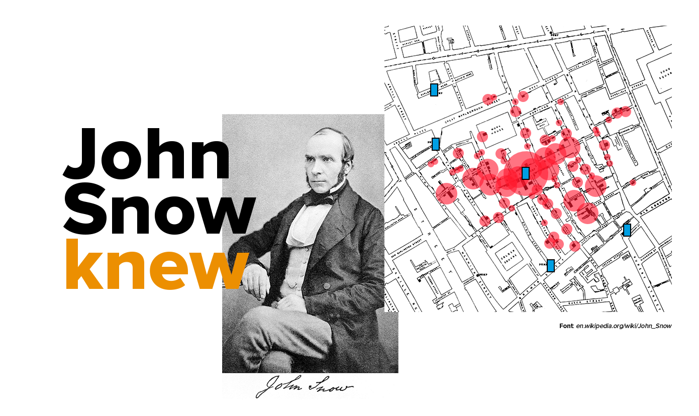
This is one of the most inspirational use of maps and location analytics in history. The outcome allowed to save lives and, to some extent, to define the future of cities as we know them.
With Mapidea, explore data in a geographical perspective - without the need of intensive training or being a specialist in Geography - and have your John Snow moment.
[London] John Snow, Epidemics from Mapidea on Vimeo.