Contents
Intro
![]() Updated
by Mapidea Team
Updated
by Mapidea Team
If you are reading this, congratulations! You are using Mapidea Location Analytics, probably the most user friendly geographic software in the world.
Using our very intuitive interface, you will be able to see your business data, on a daily basis, over a map, and extract insights impossible to see on spreadsheets or charts.
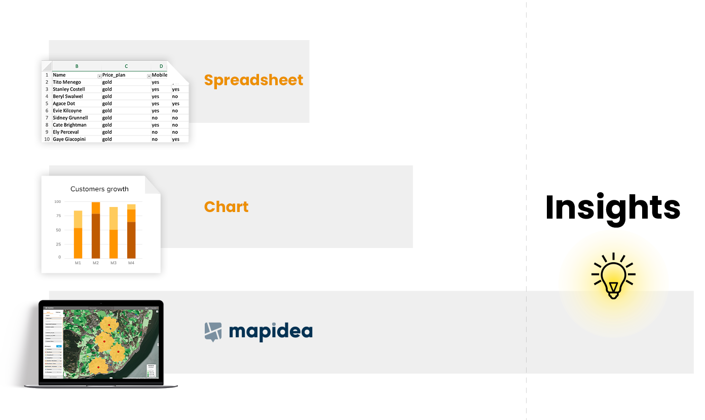
Why Where?
Human activities are getting more complex every day. Take business, for example: nowadays It's online, on the highstreet, crossing state borders, oceans and countries. But all business have one thing in common: they happen somewhere. It's this singular characteristic that allows to use business data with a spatial perspective, relating different sources, over a map.
On our personal lives, we're already using location data everyday: In apps like Uber, Airbnb or in Google Maps, to name a few. In the business world, the adoption rate was not so expressive. There is a significative number of companies that don't take advantage of Geography, just by the simple fact that they never done it before, or because the traditional options are too complicated, designed for GIS experts. If you are wondering what GIS means, you are a good example! GIS stands for Geographic Information Systems. Amazing systems used to create and analyse spatial data. They frequently have hundreds of functions and buttons, for very specific use cases.
PS - No, you don't need to be an expert in GIS to use Mapidea.

LayerCentric
Maps are one of the best ways to portrait reality: They are a simplified version of it, allowing us to deal with massive amounts of information in one single support. A canvas that humans are capable to understand at a glance.
A map is composed by different layers of information pilled up together: Roads, rivers, houses, ... In Mapidea we use layers to represent different entities - from internal sources like customers, stores, prospects, or external, like demographic data, competitors or points of interest.

So what is a layer? A layer is a group of elements of the same type, each element having certain attributes. For example, in a Business Areas layer, not only their geographical boundaries are represented, but also it can contain its name, its sales potential and more attributes.

Functionalities
We've created Mapidea with more than 20 years of experience using maps and location analytics in business. Our goal was to enable users to create their own maps and interact with them in simplified way, extracting valuable insights that will lead to better decisions.
From the hundreds of spatial functionalities available, we've selected four (4!). And with these magic number, organizations are able to solve the majority of the challenges that need location analytics. We usually say that you don't need formal training to use Mapidea: a chat with one of the Team will get you started... Or, just browse around this Help Guide and start using the power of location analytics by yourself!

Filter
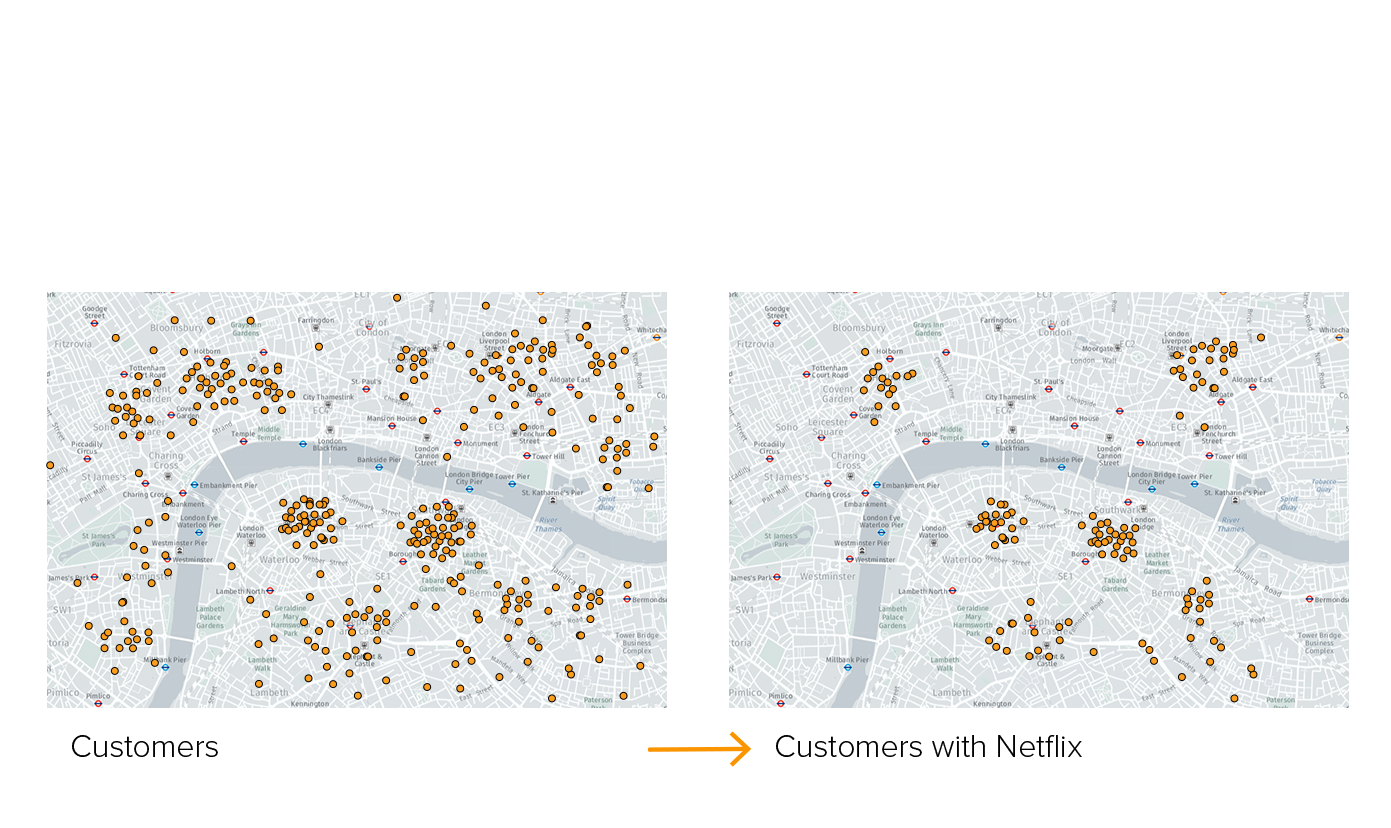
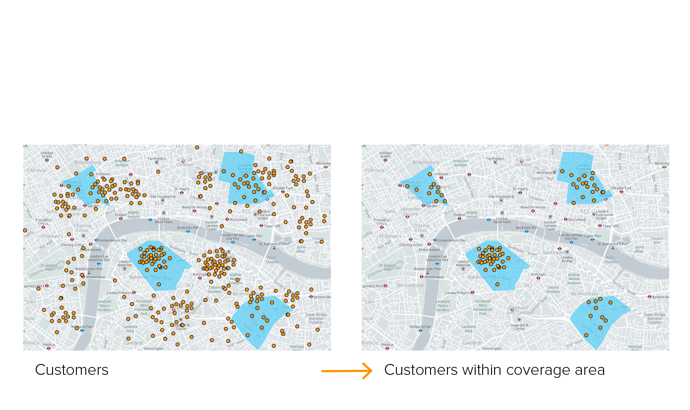
The filter function enables users to create queries and and see the result on the map. Imagine the filters that you do in Microsoft Excel, seeing the results represented in a map.
It's possible to select elements by attributes - for example, select all the customers that have Netflix, or using spatial filters - for example, select all the customers within a coverage area from a telco provider:
Calculations
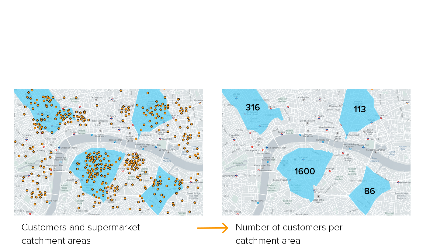
The calculation function is used to create new data, based on spatial relations between layers or using arithmetic operations (the ones typically done in Excel).
For example, to count how many customers live in a catchment area of a supermarket.
Proximity
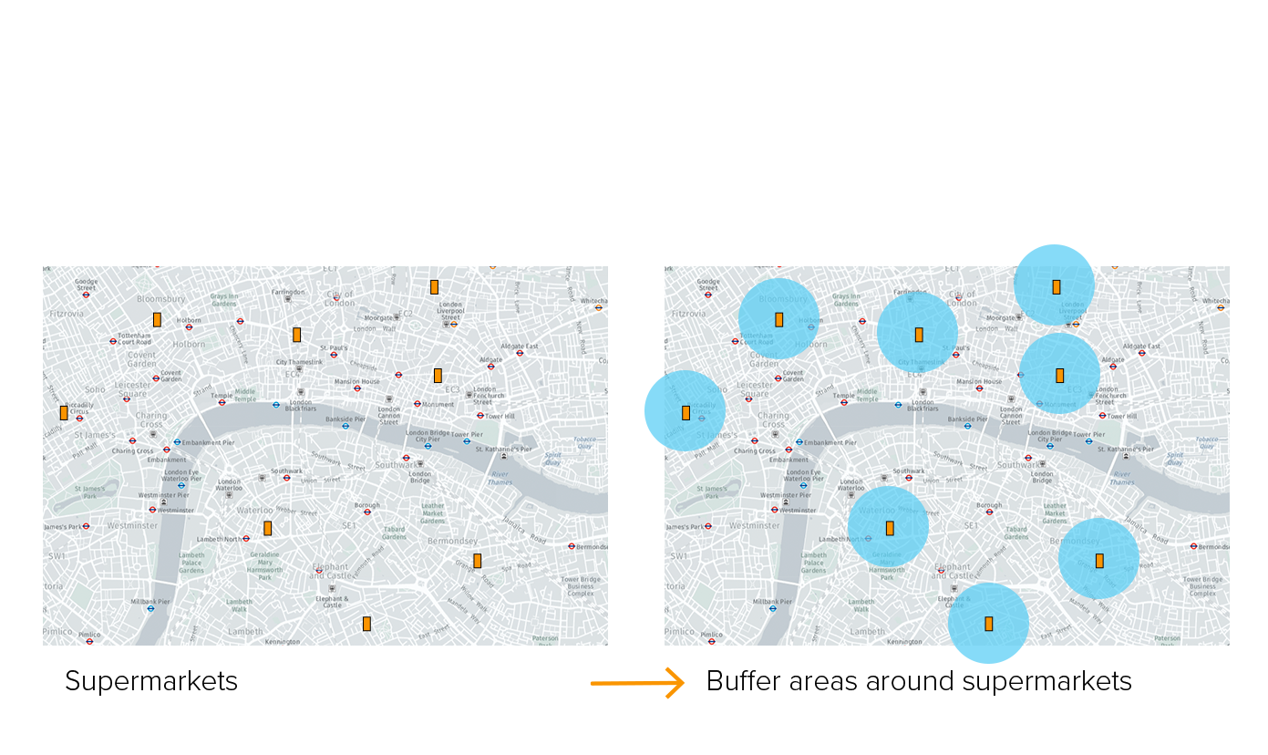
The proximity function is used to create boundaries from existing elements on the map, based on distance. For example, draw the areas up to 500 meters of all stores. You can then apply the Calculation functionality to create new data for these areas.
Maps (Thematic)
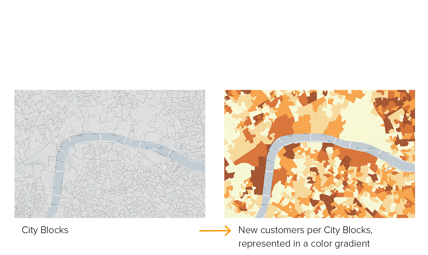
The maps functionality translates data into patterns to understand spatial distributions. For example, create a map with the number of new customers by city block.
Making a proper map includes a lot of design and process decisions - that we've simplified in Mapidea: the user only needs to know which topic he wants to see and the result will always express it in a thematic map designed and constructed with focus of being insightful.
